Linhares da Beira

Towns and Villages
Situated on the western slopes of the Serra da Estrela, the historical village of Linhares da Beira was originally a Lusitanian hill fort. In fact, the Montes Hermínios (this was the Lusitanian name for the Serra da Estrela), with its pastureland and abundant water supply and enjoying the protective shelter of the mountains, was one of the regions inhabited by this Iberian tribe, from whom many Portuguese people believe themselves to be descended. Flax (linho in Portuguese), which in the old days was one of the most important crops in the region, lay at the root of the name Linhares, which literally means flax fields.
The remains of a Roman road close to Videmonte and the discovery of milestones on the right bank of the River Mondego suggest that the Roman road connecting Viseu to Guarda passed through here. Later invaded by Visigoths and Muslims, who recognised its ideal strategic position for watching over the surrounding region, Linhares became definitively Portuguese in the time of D. Afonso Henriques, who gave it its first charter in 1169.
Peace, however, was not yet definitive. In 1189, troops from León and Castile invaded the region, pillaging and setting fire to the surrounding villages, whilst preparing to capture the castle of Celorico. Linhares came to the defence of Celorico and, finding itself encircled at the rear, the enemy´s army took flight as fast as it could. Tradition has it that all this took place on a night when there was a new moon and that this is why the coat of arms of Linhares bears a crescent and five stars.
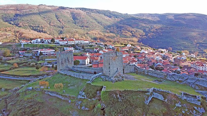
A walk through the village gives the impression of a charming whole, in which the simple granite houses stand side by side with manor-houses still displaying signs of their ancient nobility. If you look closely, you can still see many 16th-century windows. The parish church, originally Romanesque but rebuilt in the 17th century, has three valuable wood paintings attributed to the great Portuguese master painter Vasco Fernandes (Grão Vasco). A rustic tribune standing over a bench around a stone table is a unique example of the mediaeval forum, from where community decisions were announced to the local population. This is where the arms of the ancient town are displayed. Next to this stands the 16th-century granite pillory, surmounted by an armillary sphere.
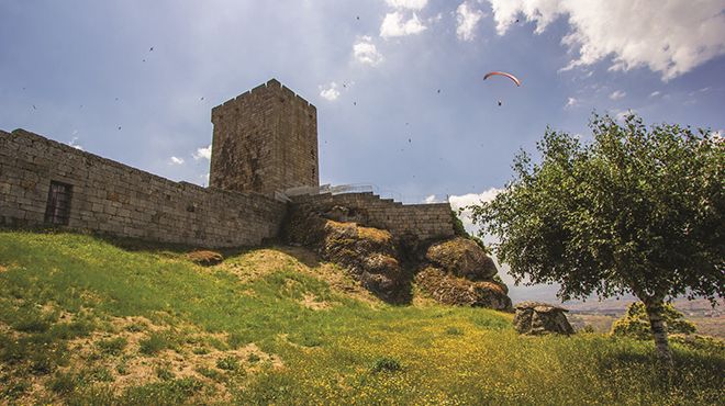
Standing proudly above the whole village is the sturdy castle that follows the geology of the terrain by being built on an enormous rock. From this viewpoint, at a height of more than 800 metres, one of the spurs of the Serra da Estrela can be seen, as well as the valley along which the River Mondego flows. Rebuilt in the 13th century by the king D. Dinis, most probably on the ruins of a Moorish fortification, it was part of the front-line defences of the Beira region and the best place for surveying all movements around. The city skyline is crowned by the impressive castle that traces the curve of the land over a huge rock outcrop and further serving as a fantastic viewpoint. Two large crenellated towers can be seen at the corners of the perimeter wall, one facing east and the other facing west. Still visible in the parade ground are the remains of some old cisterns.


 Explore
 Remember and Share


